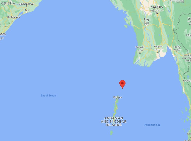
New satellite images show renewed construction on a Myanmar archipelago close to India’s strategic islands, raising concerns about China’s geopolitical intentions in the region, a British think tank said.
In a report titled “Is Myanmar building a spy base on Great Coco Island?” the independent policy institute Chatham House analyzed a number of satellite images of Coco Islands in the Bay of Bengal, taken in January this year but only recently released by the U.S. space technology firm Maxar Technologies.
The archipelago consists of two main islands, Great Coco and Little Coco, and a number of smaller islets including Jerry Island located at the southern tip of Great Coco.
They are some 55 kilometers (34 miles) north of the strategic Andaman and Nicobar Islands where India stations some major military facilities.

The images “show renewed levels of construction activity on Great Coco,” Chatham House said in a new report.
The most recognizable change was the lengthening of the airport runway from 1,300 meters over ten years ago to 2,300 meters. Analysts said the runway was also widened and two new hangars were added.
“The width of the hangar appears to be close to 40 meters, limiting the list of aircraft it may eventually accommodate but opening the possibility for high-performance aircraft to be stationed there,” they said.

The report’s authors spotted some new buildings to the north of the airport, a radar station and “a large pier is also visible.”
In the southern part of the island, a causeway can be seen under construction, connecting the tip of the Great Coco to Jerry Island. Some land clearance is visible on the latter, they said, “indicating the future extension of Great Coco’s facilities.”
China’s involvement?
Chatham House’s analysis of Maxar’s imagery did not reveal any foreign military presence on Coco Islands, contrary to the rumors that China installed a signals intelligence station here in the early 1990s.
The latest images however revealed that “Myanmar may soon be intending to conduct maritime surveillance operations from Great Coco Island.”
“Growing evidence suggests Myanmar’s military coup has increased Beijing’s influence in the country,” the report said, pointing to China’s large investment projects in Myanmar that lead to Beijing’s increasing influence over the Tatmadaw, or the Myanmar military.
“With the Coco Island developments, India may soon face a new airbase close by in a country increasingly tied to Beijing,” the analysts said, “The militarization of the Coco Islands by the Tatmadaw, combined with the wider Chinese developments occurring inland, could pose a significant security challenge to India and its navy.”

The Coco Islands are 1,200 kilometers (746 miles) from the Strait of Malacca, through which around 40% of global trade passes. China has long been interested in securing access to this critical trade route.
In 2018, China and Myanmar signed a memorandum of understanding on the establishment of the so-called China-Myanmar Economic Corridor, part of the Belt and Road Initiative, under which China will help Myanmar develop major infrastructure projects including roads, railways, and seaports.
There are fears it would increase Myanmar’s economic dependence on China, giving Beijing significant geopolitical leverage.
Edited by Mike Firn.

